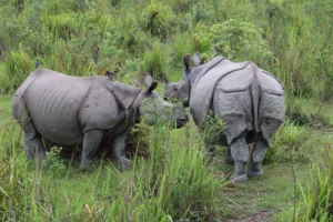
Learn wildlife tracking basics, from identifying animal tracks and field signs to understanding GPS, radio, satellite, and acoustic tracking used in modern conservation.
Introduction, Wildlife Tracking Fundamentals & Why It Matters
Wildlife Tracking Basics
Wildlife tracking is the practice of finding, identifying, and interpreting evidence left behind by animals to understand where they have been, how they move, what they are doing, and how they interact with their environment. For centuries, people relied on footprints, droppings, feeding marks, nests, and other field signs to locate wildlife. Today, researchers also use technologies such as GPS collars, radio transmitters, satellite tags, and acoustic sensors to study animal movements over much larger areas.
Although the tools have evolved, the purpose remains largely the same: to better understand wildlife without relying solely on direct observation. Tracking helps reveal behaviour that would otherwise remain hidden, from daily feeding routes to seasonal migrations and breeding movements.
Whether you are a safari visitor hoping to recognise fresh tiger pugmarks, a birdwatcher curious about migration, or simply someone interested in nature, learning the basics of wildlife tracking adds a new dimension to outdoor experiences. Instead of looking only for animals, you begin to notice the many clues they leave behind.
What Is Wildlife Tracking?
Wildlife tracking is the process of gathering information about animals through either physical signs left in the environment or specialised monitoring technologies. Both approaches help answer important questions about animal behaviour, movement, habitat use, and survival.
Traditional tracking focuses on evidence such as:
- Footprints and track patterns
- Scat (droppings)
- Feeding signs
- Scratch marks and scrapes
- Bedding sites
- Trails and pathways
- Nests, burrows, or dens
Modern wildlife research expands these observations using electronic tracking devices that record an animal’s location or movement over time. These technologies allow scientists to monitor species that travel long distances, live underwater, fly across continents, or remain active mainly at night.
Wildlife Tracking vs Wildlife Telemetry
The two terms are often used interchangeably, but they are not identical.
Wildlife tracking is the broader concept. It includes reading natural field signs as well as using technology to follow animals.
Wildlife telemetry refers specifically to electronic systems that transmit or store information from devices attached to animals, such as GPS collars, radio transmitters, satellite tags, or acoustic transmitters.
In simple terms, every telemetry study is a form of wildlife tracking, but not every wildlife tracking activity involves telemetry.
| Wildlife Tracking | Wildlife Telemetry |
| Includes natural field signs and technology | Uses electronic devices only |
| Can be practised by beginners | Usually conducted by trained researchers |
| Often relies on observation and interpretation | Produces digital movement data |
| Useful for education, safaris, and ecology | Essential for scientific monitoring and conservation |
Why Wildlife Tracking Matters
Wildlife tracking provides information that cannot be obtained through occasional sightings alone.
For researchers, tracking reveals how animals use landscapes, where they migrate, how large their home ranges are, and which habitats are most important for feeding or breeding. Such information helps conservation agencies protect migration corridors, identify critical habitats, and make informed management decisions.
For wildlife travellers and photographers, tracking improves the ability to interpret the environment. Fresh tracks on a forest road, scratch marks on a tree, or recently disturbed soil may indicate recent animal activity even when the animal itself remains out of sight.
Tracking also helps people appreciate that wildlife is present even when forests appear quiet. Every footprint, feeding sign, or trail tells part of an animal’s story, encouraging more careful observation and a deeper understanding of natural ecosystems.
Field Note
Experienced naturalists rarely rely on a single clue. A footprint becomes far more meaningful when considered alongside nearby scat, feeding signs, vegetation disturbance, weather conditions, and the surrounding habitat. Combining multiple pieces of evidence usually leads to a more reliable interpretation than focusing on one sign alone.
Understanding Traditional Wildlife Tracking
Traditional wildlife tracking is based on observing the physical evidence animals leave behind as they move through their habitat. Long before GPS collars and satellite tags existed, trackers learned to interpret footprints, droppings, feeding marks, and other signs to understand where animals had been, what they were doing, and where they might go next. Even today, these skills remain valuable for researchers, park staff, naturalists, and wildlife enthusiasts.
Rather than relying on a single clue, experienced trackers combine multiple signs with knowledge of habitat, weather, and animal behaviour. This approach reduces guesswork and provides a more complete picture of wildlife activity.
Animal Footprints and Track Patterns
Footprints, often called tracks, are usually the first signs people notice. A single footprint can help identify an animal, but a series of tracks often reveals much more.
Track patterns may indicate:
- The species that passed through
- The direction of travel
- Approximate body size
- Whether the animal was walking, running, or jumping
- Whether it was alone or moving with others
For example, a straight, purposeful trail often suggests an animal travelling between feeding or resting areas, while irregular tracks with frequent turns may indicate active foraging.
Looking Beyond Individual Prints
Instead of focusing on one footprint, observe the entire trail.
Ask yourself:
- Does the animal maintain a straight path?
- Does it stop frequently?
- Does it circle an area?
- Are there signs of feeding nearby?
- Are there tracks from multiple individuals?
These observations often provide more useful information than footprint shape alone.
Tracks Tell a Story
Tracks can reveal far more than simply which species passed by.
A well-preserved trail may help indicate:
| Observation | Possible Interpretation |
| Deep impressions | Soft ground, heavy animal, or rapid movement |
| Widely spaced footprints | Faster travel or longer stride |
| Closely spaced prints | Slow movement or cautious behaviour |
| Overlapping tracks | Animal changed direction or paused |
| Multiple sets of tracks | Group movement or repeated use of the same trail |
These interpretations should always be considered alongside habitat conditions and other field evidence rather than viewed as definitive conclusions.
Scat, Feeding Signs, and Other Field Clues
Experienced trackers rarely depend on footprints alone. Animals constantly leave other signs that help build a clearer understanding of their behaviour.
Scat (Droppings)
Scat can provide useful clues about:
- Recent animal presence
- Feeding habits
- Habitat use
- Movement patterns
Researchers often analyse scat to study diet, genetics, parasites, and population health without disturbing the animals themselves.
For beginners, however, scat should only be observed visually. Avoid touching it because it may contain harmful bacteria or parasites.
Feeding Signs
Many animals leave distinctive evidence while feeding.
Examples include:
- Bark stripped from trees
- Chewed branches
- Gnawed nuts or seeds
- Dug-up soil
- Grazed vegetation
- Partially eaten prey
These signs help indicate not only which species may be present but also what resources they are using within the habitat.
Scrapes and Scratch Marks
Some animals deliberately leave marks on trees or the ground.
These may serve several purposes:
- Territory marking
- Communication with other animals
- Scent marking
- Display behaviour
Scratches should always be interpreted together with nearby tracks and habitat features rather than in isolation.
Bedding Sites
Many mammals create temporary resting places.
These bedding sites may appear as:
- Flattened grass
- Depressions in leaf litter
- Sheltered ground beneath shrubs
- Dry resting spots protected from wind
Finding a bedding site often suggests that the animal spent some time in the area rather than simply passing through.
Trails and Pathways
Wildlife frequently uses the same routes repeatedly.
Common wildlife trails may connect:
- Water sources
- Feeding areas
- Resting sites
- Breeding locations
Repeated use often creates narrow paths through vegetation, especially in forests and grasslands.
Reading Freshness and Direction
One of the most useful tracking skills is estimating whether signs are recent.
Although it is rarely possible to determine an exact age from tracks alone, several environmental factors help provide clues.
Track freshness depends on:
- Rainfall
- Wind
- Sun exposure
- Soil moisture
- Human or animal disturbance
Fresh tracks generally retain sharper edges, while older tracks become softer and less distinct as weather gradually alters their appearance. However, the rate of change varies greatly depending on local conditions, so freshness should always be interpreted cautiously rather than assumed.
Direction of travel can often be estimated by examining the overall track sequence rather than a single footprint. Following the trail from a respectful distance helps reveal where the animal came from and where it was likely heading.
How Weather and Ground Conditions Affect Tracks
The environment strongly influences both the visibility and preservation of wildlife signs.
Some surfaces preserve tracks particularly well, while others leave little evidence.
Good Tracking Surfaces
- Wet sand
- Soft mud
- Damp soil
- Snow
- Fine dust
These conditions often produce clearer footprints that remain visible for longer periods.
Difficult Tracking Surfaces
- Rocky ground
- Thick leaf litter
- Dry gravel
- Dense grass
- Hard-packed trails
On these surfaces, trackers may rely more heavily on broken vegetation, feeding signs, scat, or other indirect evidence instead of footprints alone.
Expert Tip
When learning wildlife tracking, avoid trying to identify every sign immediately. Start by observing broad patterns—where animals move, where they feed, and how different habitats influence the clues they leave behind. Developing careful observation skills is often more valuable than memorising individual footprints.
Photography Tip
If you photograph animal tracks for later identification, capture images from directly above and include a familiar object, such as a ruler or coin, for scale. Also photograph the surrounding habitat, as environmental context can be just as informative as the track itself.
Responsible Tourism Tip
Observe tracks and field signs without disturbing them. Avoid following fresh trails too closely, entering sensitive habitats, or attempting to approach wildlife based solely on recent signs. Responsible observation minimises stress on animals and helps preserve natural behaviour.
Modern Wildlife Tracking Technologies and Species-Specific Applications
Traditional field tracking remains valuable, but many wildlife studies require information that cannot be obtained from footprints or other visible signs alone. Animals may travel hundreds or even thousands of kilometres, move primarily at night, spend most of their lives underwater, or inhabit remote landscapes where direct observation is difficult.
To overcome these challenges, researchers use a range of tracking technologies. Each method is designed for specific species, habitats, and research objectives, so there is no single “best” solution. In many studies, scientists combine several techniques to build a more complete understanding of animal movement and behaviour.
Modern Wildlife Tracking Technologies
GPS Tracking
Global Positioning System (GPS) tracking is one of the most widely used tools in wildlife research. Small GPS devices attached to animals periodically record their locations using satellites.
Depending on the device and study design, GPS units can collect location data at intervals ranging from minutes to hours before storing or transmitting the information for analysis.
GPS tracking helps researchers study:
- Home range size
- Daily movement patterns
- Migration routes
- Habitat preferences
- Seasonal behaviour
- Responses to environmental change
Because GPS provides precise location data, it has become particularly valuable for monitoring wide-ranging terrestrial mammals such as large carnivores and ungulates. However, GPS devices require sufficient battery life and may perform less effectively in environments where satellite signals are obstructed, such as dense forests or steep valleys.
Expert Tip
GPS data shows where an animal has been, but it does not always explain why it moved. Researchers often combine location data with habitat information, weather, and field observations to interpret behaviour more accurately.
Radio Telemetry
Before GPS technology became widely available, radio telemetry was one of the primary methods for tracking wildlife, and it continues to play an important role today.
Animals are fitted with small radio transmitters that emit unique signals. Researchers then use directional antennas and receivers to locate the animal manually.
Radio telemetry is particularly useful when:
- Continuous satellite coverage is unnecessary.
- Study areas are relatively small.
- Researchers need to locate animals directly in the field.
- Lightweight equipment is required.
Unlike GPS systems, radio telemetry requires active fieldwork, making it more labour-intensive but still highly effective for many research projects.
Satellite Tracking
Satellite telemetry extends wildlife monitoring far beyond the range of traditional radio systems.
Instead of relying on nearby researchers, satellite tags transmit movement data through satellite networks, allowing scientists to monitor animals across countries, oceans, and even continents.
Satellite tracking is especially valuable for:
- Migratory birds
- Marine mammals
- Sea turtles
- Wide-ranging terrestrial species
Its greatest advantage is the ability to monitor long-distance movements across remote regions where field teams cannot easily follow animals.
Acoustic Telemetry
Many aquatic animals spend most of their lives underwater, making GPS and conventional radio systems unsuitable.
Acoustic telemetry solves this challenge by using sound rather than radio signals.
Small acoustic transmitters attached to fish or marine animals emit coded sound pulses that are detected by underwater receivers positioned throughout rivers, lakes, estuaries, or coastal waters.
Researchers use acoustic telemetry to investigate:
- Migration timing
- Habitat use
- Spawning movements
- Survival rates
- Connectivity between aquatic habitats
Large collaborative receiver networks allow scientists to follow tagged animals over extensive geographic areas, providing valuable information for fisheries management and aquatic conservation.
Radar and Computer Vision
Wildlife monitoring continues to evolve through advances in remote sensing and artificial intelligence.
Modern systems increasingly use:
- Weather radar to detect large-scale movements of birds and insects
- Computer vision to identify animals automatically in aerial imagery
- Machine learning to process large movement datasets
- Automated image analysis to reduce manual identification
These technologies complement, rather than replace, traditional fieldwork and telemetry by allowing researchers to analyse wildlife at broader spatial and temporal scales.
Comparing Wildlife Tracking Technologies
| Method | Best For | Main Strength | Main Limitation |
| GPS Tracking | Large terrestrial animals | Highly accurate location data | Battery life and satellite reception |
| Radio Telemetry | Local field studies | Reliable and relatively lightweight | Requires researchers to track signals manually |
| Satellite Tracking | Long-distance migrants | Global coverage | Higher equipment and operational costs |
| Acoustic Telemetry | Fish and marine wildlife | Effective underwater monitoring | Requires receiver networks |
| Radar & Computer Vision | Birds, insects, landscape-scale monitoring | Large-area observation and automated analysis | Often combined with other tracking methods for interpretation |
No single technology is suitable for every species or research objective. Scientists select methods based on animal size, behaviour, habitat, research goals, and logistical considerations.
Wildlife Tracking Across Different Animal Groups
Different animals present different tracking challenges. Their body size, movement patterns, and habitat determine which methods are most appropriate.
Large Terrestrial Mammals
Large mammals such as deer, elephants, wolves, and big cats are often studied using GPS collars or radio transmitters.
These devices help researchers understand:
- Territory size
- Seasonal movements
- Habitat selection
- Human-wildlife interactions
- Dispersal of young animals
Traditional field signs such as footprints, scat, and scratch marks continue to complement electronic tracking, especially during field surveys.
Birds
Birds can travel extraordinary distances, making them particularly challenging to study.
Researchers may use:
- Lightweight GPS tags
- Satellite transmitters
- Radio telemetry
- Weather radar
- Automated monitoring systems
These approaches help reveal migration routes, breeding areas, stopover sites, and seasonal timing.
Fish and Marine Wildlife
Underwater environments require specialised tracking systems.
Depending on the species and research objectives, scientists may use:
- Acoustic transmitters
- Archival tags
- Satellite tags for surfacing species
These methods help researchers understand movement between habitats, migration corridors, and habitat connectivity in rivers, lakes, estuaries, and oceans.
Reptiles and Amphibians
Some reptiles and amphibians are also monitored using miniature transmitters or GPS devices where suitable.
Tracking data helps researchers study:
- Nesting behaviour
- Seasonal habitat use
- Wetland connectivity
- Responses to environmental change
Because many of these animals are relatively small, equipment size and animal welfare remain important considerations when selecting tracking methods.
Decision Guide: Choosing the Right Tracking Method
| Research Goal | Suitable Method |
| Identify tracks during a safari | Traditional field tracking |
| Study daily movement of land mammals | GPS tracking |
| Monitor local wildlife populations | Radio telemetry |
| Track long-distance migration | Satellite tracking |
| Study fish or marine species | Acoustic telemetry |
| Observe large-scale bird movements | Radar and automated monitoring |
Field Note
Modern conservation rarely depends on a single tracking technology. Researchers increasingly combine field observations, GPS, telemetry, environmental data, and computer-based analysis to obtain a more complete understanding of wildlife movement and behaviour. This integrated approach improves both scientific interpretation and conservation planning.
Photography Tip
Wildlife photographers can often improve their chances of finding animals by learning to recognise natural field signs such as tracks, feeding evidence, and frequently used trails. However, always maintain a safe distance and avoid disturbing wildlife for the sake of a photograph.
Responsible Tourism Tip
Electronic tracking devices are used only under authorised research programmes with appropriate ethical oversight. Visitors should never attempt to attach tracking devices, handle wild animals, or interfere with ongoing research activities.
How Wildlife Tracking Supports Conservation
Wildlife tracking is far more than a scientific exercise. By showing how animals move through landscapes and seascapes, tracking provides evidence that helps conservation organisations make informed decisions about habitat protection, species recovery, and wildlife management. Information collected through field observations and modern tracking technologies supports conservation planning at local, regional, and even international scales.
Understanding Migration and Seasonal Movement
Many species depend on access to different habitats throughout the year. Some migrate between breeding and wintering grounds, while others shift their range in response to food availability, rainfall, or seasonal weather.
Tracking helps researchers answer questions such as:
- Where do animals travel?
- Which routes do they use repeatedly?
- Where do they stop to feed or rest?
- Which habitats are essential for breeding or raising young?
Identifying these movement patterns allows conservation agencies to protect critical migration corridors rather than focusing only on isolated protected areas.
Protecting Important Habitats
Animals rarely use every part of a landscape equally.
Tracking studies often reveal:
- Frequently used feeding areas
- Resting sites
- Breeding locations
- Nursery habitats
- Seasonal refuges
This information helps conservation managers prioritise habitats that provide the greatest ecological value.
Reducing Human–Wildlife Conflict
Understanding animal movement can also help reduce conflicts between people and wildlife.
For example, tracking data may identify:
- Frequently crossed roads
- Agricultural areas visited by wildlife
- Seasonal movement routes near villages
- Important wildlife corridors
Such knowledge can support practical management decisions, although the exact measures depend on local conditions and management objectives.
Responding to Environmental Change
Wildlife movement often changes in response to drought, wildfire, habitat fragmentation, urban development, or changing climate conditions.
Long-term tracking programmes allow researchers to monitor how species adapt over time by revealing changes in migration timing, habitat use, or movement patterns. Combining movement data with environmental information provides a stronger foundation for conservation planning than either source alone.
Beginner’s Guide to Wildlife Tracking
Learning wildlife tracking begins with careful observation rather than specialised equipment. Developing patience and attention to detail is often more valuable than identifying every footprint correctly.
Essential Field Equipment
Beginners can start with a simple kit:
- Comfortable walking shoes
- Notebook or field journal
- Pencil
- Camera or smartphone
- Binoculars
- Measuring tape or small ruler
- Field guide for local wildlife
- Drinking water and basic safety supplies
These tools help document observations without disturbing wildlife.
Practical Checklist Before Heading Into the Field
✔ Learn about the wildlife found in your destination.
✔ Check weather conditions.
✔ Stay on designated trails whenever possible.
✔ Carry sufficient drinking water.
✔ Inform someone about your planned route if visiting remote areas.
✔ Observe quietly and patiently.
✔ Photograph tracks rather than disturbing them.
✔ Record habitat, weather, and location along with your observations.
Ethics and Safety
Responsible wildlife tracking always places animal welfare first.
Good practices include:
- Observe from a respectful distance.
- Never chase or corner wildlife.
- Avoid disturbing nests, dens, or resting animals.
- Leave tracks and other field signs undisturbed whenever possible.
- Follow local park rules and guidance from authorised staff.
- Never attempt to capture or handle wild animals.
Wildlife tracking should increase appreciation of nature without altering natural animal behaviour.
Common Misconceptions About Wildlife Tracking
Several misconceptions can make wildlife tracking seem either easier or more complicated than it really is.
Misconception 1: Wildlife Tracking Only Uses GPS
Modern wildlife tracking includes both traditional field observation and technologies such as GPS, radio telemetry, satellite tracking, acoustic telemetry, radar, and bio-logging. GPS is only one part of a much broader field.
Misconception 2: One Footprint Is Enough for Identification
A single footprint rarely provides complete information. Experienced trackers combine footprints with scat, feeding signs, habitat, weather conditions, and movement patterns before drawing conclusions.
Misconception 3: Larger Tracking Devices Always Produce Better Data
Tracking equipment must balance data collection with animal welfare. Device size, battery life, and species biology all influence which technology is appropriate.
Misconception 4: Wildlife Tracking Is Only for Scientists
Anyone can begin learning observation-based wildlife tracking. While electronic tagging requires specialist training and permits, recognising tracks and field signs is a skill that recreational naturalists, photographers, and safari visitors can develop responsibly.
Frequently Asked Questions
What is wildlife tracking?
Wildlife tracking is the process of understanding animal movement and behaviour by interpreting natural field signs or using technologies such as GPS, radio, satellite, or acoustic telemetry.
Is wildlife tracking the same as telemetry?
No. Telemetry refers specifically to electronic tracking systems, while wildlife tracking also includes traditional methods such as interpreting footprints, scat, and other field signs.
Why do scientists track animals?
Tracking helps researchers study migration, habitat use, movement patterns, breeding behaviour, and conservation needs.
What signs should beginners look for first?
Footprints, trails, scat, feeding signs, and disturbed vegetation are among the easiest clues to recognise during field observations.
Which animals are commonly tracked?
Researchers track a wide variety of mammals, birds, reptiles, amphibians, fish, and marine species using methods suited to each animal’s biology and habitat.
Does wildlife tracking harm animals?
When conducted under approved research programmes, tracking aims to minimise disturbance while collecting valuable scientific information. Researchers carefully consider animal welfare when selecting tracking methods.
Can I practise wildlife tracking during a safari?
Yes. Many national parks and wildlife reserves offer excellent opportunities to observe tracks and other field signs. Always remain on authorised routes and follow instructions from guides and park authorities.
Which surface is best for finding animal tracks?
Soft mud, damp soil, wet sand, and snow usually preserve footprints better than rocky or heavily vegetated ground.
Conclusion
Wildlife tracking combines centuries-old observation skills with modern scientific technology to reveal how animals move, survive, and interact with their environment. Whether reading footprints on a forest trail or analysing data from satellite-linked tags, the goal remains the same: understanding wildlife while minimising disturbance.
For beginners, learning to recognise tracks, scat, feeding signs, and movement patterns can make every walk in nature more engaging. For researchers and conservation organisations, advanced tracking technologies provide information that supports habitat protection, migration studies, and evidence-based wildlife management.
Perhaps the most valuable lesson wildlife tracking teaches is patience. Animals often leave subtle clues long before they are seen. By learning to interpret these signs carefully and responsibly, we gain a deeper appreciation of wildlife and the landscapes they inhabit.