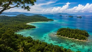
Plan a responsible journey to the Dibang Wildlife Landscape. Learn about high-altitude tigers, the Mishmi takin, and practical travel permit logistics.
Introduction, Overview & Planning
The Dibang Wildlife Landscape, situated in the remote Mishmi Hills of the Upper Dibang Valley in Arunachal Pradesh, is a montane mosaic of temperate and alpine forests. The region shelters unique mammals—ranging from the Mishmi takin and red panda to recently confirmed high-altitude tigers. Today, this terrain sits at the intersection of urgent wildlife conservation initiatives and contested infrastructure development projects.
For wildlife researchers, field naturalists, and independent travelers, understanding Dibang requires looking past standard travel brochures. This is a region defined by extreme terrain, low human population density, and complex community-led conservation systems. Navigating it successfully requires careful attention to legal permits, seasonal weather shifts, and local cultural protocols.
Quick facts about Dibang Wildlife Landscape
When planning a survey, research project, or natural history journey to this part of Northeast India, the scale and administrative boundaries of the landscape can be difficult to parse. The following data establishes the physical baseline of the area:
| Metric | Details & Statistics |
| Dibang Wildlife Sanctuary Area | ~4,149 km² |
| Key Biodiversity Area (KBA) Listing | ~4,644 km² |
| Upper Dibang Valley District Area | ~9,129 km² |
| Human Population Density | Extremely low (~1 person/km²) |
| Highest Recorded Tiger Elevation | ~3,630 m AMSL |
| Major Scientific Survey Window | 2015–2017 (Wildlife Institute of India) |
Understanding the Dibang Landscape: Geography and Accessibility
Anini serves as the primary administrative gateway to the landscape. Reaching this sector requires significant travel time due to the steep gorges and montane roads of the Mishmi Hills. Travelers must secure specific domestic inner line permits or protected area permits before arrival, as security and community protocols are strictly enforced across the district borderlands.
The landscape forms an integral part of the wider Dihang-Dibang Biosphere Reserve complex. Because it shares international borders with the montane tracts of Tibet, the area functions as a contiguous transboundary wildlife corridor. This geographical position directly influences the composition of its flora and fauna, blending species from the Eastern Himalayas with Palearctic wildlife elements.
📋 Field Note
The low human population density within the Upper Dibang Valley means that large swathes of habitat remain unfragmented by major urban settlements. However, the terrain is exceptionally rugged, characterized by sheer river valleys and high-altitude plateaus that can limit physical access during the monsoon season.
Landscape Geography, Habitat Zones & Specialized Wildlife Profiles
Landscape, climate and habitat zones
Understanding the geography of the Dibang Wildlife Landscape is essential before planning any field work or visit. The terrain dictates both what wildlife you might encounter and how difficult it will be to reach them. The region is characterized by steep elevational gradients, deep gorges, and remote high-altitude plateaus that can make logistics highly challenging.
The drastic changes in elevation across the Mishmi Hills create distinct vegetation bands. Lower elevations feature temperate broadleaf and coniferous forests, which transition into subalpine and alpine scrub as you move higher. This means that within a single expedition, researchers and trackers pass through entirely different ecological systems, each supporting distinct fauna. Because of this rugged topography, weather conditions are localized and can change rapidly, heavily influencing visibility and access to trailheads.
📷 Photography Tip
If you are documenting species in the lower temperate broadleaf zones, prepare for low-light conditions under dense canopy cover and frequent mist. Fast lenses and weather-sealed gear are necessary, especially if you plan to shoot during the damp shoulder seasons.
Wildlife highlights and species profiles
The intersection of Palearctic and Indo-Malayan geographic zones results in a highly specialized species assembly. While district and local government sources list approximately 156 mammal species and 137 bird species for the area, these figures often fluctuate depending on the specific survey methodologies used.
The mammalian fauna includes elusive carnivores and specialized mountain ungulates. Alongside the high-profile species discussed below, the landscape supports populations of red panda (Ailurus fulgens), Asian black bear (Ursus thibetanus), dhole (Cuon alpinus), goral (Naemorhedus goral), serow (Capricornis thar), and musk deer (Moschus spp.). The region is also highly regarded by ornithologists for its diverse Himalayan galliformes and pheasants.
Table 2: Key Species Checklist and Conservation Status
| Species | IUCN / Conservation Context | Evidence / Documentation |
| Tiger (Panthera tigris) | Endangered | High-altitude camera-trap records |
| Mishmi takin (Budorcas taxicolor) | Vulnerable / Regionally Endemic | Direct sightings & local tracking |
| Red panda (Ailurus fulgens) | Endangered | Sighted in temperate forest zones |
| Asian black bear (Ursus thibetanus) | Vulnerable | Camera-trap records & field signs |
| Dhole (Cuon alpinus) | Endangered | Camera-trap records |
Mishmi takin — ecology and status
The Mishmi takin (Budorcas taxicolor) is one of the most sought-after records for mammal watchers and field biologists visiting Arunachal Pradesh. This heavily built, goat-antelope is regionally endemic and adapted to steep, rugged terrain. They primarily inhabit the subalpine and alpine scrub zones. Tracking the Mishmi takin requires excellent physical fitness and local tracking expertise, as their preferred habitats involve navigating dense bamboo thickets and steep ravines far from established roads.
Tigers at high elevation — camera-trap records
A common misconception in wildlife travel is that tigers are strictly confined to lowland tropical forests and plains. The Dibang landscape has definitively proven otherwise. Between 2015 and 2017, intensive camera-trap surveys produced the first photographic evidence of tigers within the Dibang Wildlife Sanctuary.
These are not isolated lower-valley anomalies. Camera traps have documented tigers utilizing high-altitude habitats, with the highest photographic record occurring at approximately 3,630 meters above sea level. This represents the highest recorded elevation for tiger presence in the Indian Eastern Himalaya. Understanding how tigers utilize these high-altitude plateaus and steep valleys is now a primary focus for ongoing carnivore research in the region.
Scientific Surveys, Camera-Trap Discoveries & Idu Mishmi Cultural Conservation
Scientific surveys and baseline studies
The dense vegetation and rugged topography of the Dibang Wildlife Landscape historically limited comprehensive ecological research. However, significant progress occurred between 2015 and 2017 when the Wildlife Institute of India (WII) and state forest departments conducted intensive camera-trap surveys. These studies successfully established essential ecological baselines for large carnivores and their prey across the sanctuary.
The most notable outcome of this survey period was securing the first definitive photographic evidence of tigers within the Dibang Wildlife Sanctuary. Prior to these camera-trap outputs and a notable tiger cub rescue in 2012, evidence of tigers in the upper valley was largely anecdotal. The photographic capture of a tiger at approximately 3,630 meters above sea level confirmed the landscape’s ecological importance and provided the highest altitude tiger record in the Indian Eastern Himalaya.
For researchers, these studies form the foundation for any modern fieldwork in the region. Datasets, including camera-trap records and technical reports detailing survey methods from 2015 to 2025, are maintained in the WII digital repository. Field biologists seeking to conduct follow-up monitoring should consult these existing baselines to understand the sampling effort and trap-grid methodologies previously deployed.
People, culture and local perspectives
A prevalent misconception in wildlife conservation is that protected sanctuaries are sterile environments devoid of human history. In Dibang, the ecological landscape is inextricably linked to the Idu Mishmi community. The traditional territories of the Idu Mishmi overlap significantly with the Dibang Wildlife Sanctuary, which was formally established in 1998.
The Idu Mishmi maintain deep cultural relations with the region’s wildlife, observing traditional practices and taboos that have historically regulated hunting and protected key species. However, external proposals to elevate the region’s protection status—such as the discussions around a dedicated Dibang Tiger Reserve—have generated mixed sentiments locally. Community members frequently raise concerns regarding the potential loss of traditional land rights, restrictions associated with Eco-Sensitive Zones (ESZ), and changes to community forest management.
Recent dialogue emphasizes the necessity of a culturally sensitive conservation framework. The Idu Mishmi have advocated for a community-based “cultural model” for tiger conservation that insists on genuine consultation and co-design, rejecting superficial tokenism. Recognizing and respecting these socio-political realities is mandatory for any researcher, policy advisor, or traveler operating in the Dibang Valley.
🤝 Responsible Tourism Tip
When traveling through the Dibang landscape, acknowledge that you are moving through ancestral lands. Conservation here is an active, ongoing negotiation between state policies and indigenous rights. Always prioritize hiring local Idu Mishmi guides and remain attentive to local sentiments regarding land use and wildlife protection.
Hydropower Pressures, Policy Debates & Strategic Conservation Recommendations
Major threats and development pressures
While the Dibang Wildlife Landscape remains relatively insulated from mass tourism and heavy industrial logging, it faces profound, landscape-level development pressures. Poaching, unmanaged fuelwood collection, and localized tree-felling present ongoing challenges at the community level. However, it is the push for large-scale infrastructure—specifically river basin developments—that poses the most urgent threat to the region’s Key Biodiversity Area (KBA) status.
The construction of new border roads is also rapidly changing access to previously remote valleys. While these roads are critical for national security and local connectivity, they inevitably increase the risk of habitat fragmentation and open up once-inaccessible high-altitude plateaus to an increased human footprint.
Hydropower projects and cumulative impacts
The most significant ecological threat to the Dibang basin is the proposed network of large-scale hydroelectric dams. The Etalin Hydropower Project, alongside other Dibang basin developments, has generated intense national and international debate.
Assessing the impact of these projects requires moving beyond a single-dam analysis. Cumulative Environmental Impact Assessments (CEIA) and carrying-capacity studies commissioned by the Ministry of Environment, Forest and Climate Change (MOEF) have highlighted the aggregate risks of multiple cascading dams on the region’s biodiversity. For researchers and policy advisors, understanding the footprint of these projects—which threaten to submerge primary forests and disrupt critical riparian corridors—is crucial when evaluating the long-term viability of the landscape’s flora and fauna.
Table 3: Primary Conservation Threats and Impact Zones
| Threat Category | Affected Zone | Evidence & Impact | Primary Stakeholders / Drivers |
| Hydropower Dams | Lower valleys & river basins | Forest submergence; cumulative basin impacts | Government policy; power corporations |
| Road Construction | Border regions & steep slopes | Habitat fragmentation; increased accessibility | Infrastructure & security development |
| Poaching / Hunting | Unprotected community forests | Depletion of ungulate & small mammal populations | Localized bushmeat demand; illegal trade |
| Fuelwood Collection | Periphery of settlements | Localized tree-felling & forest degradation | Domestic energy needs |
Conservation policy, KBA and future proposals
The policy landscape governing the Dibang Wildlife Sanctuary is currently in a state of flux. The sanctuary is recognized globally as a Key Biodiversity Area (KBA) encompassing approximately 4,644 km². However, domestic conservation proposals have sparked complex local debates.
Following the successful camera-trap baseline surveys conducted by the Wildlife Institute of India (WII), which provided scientific evidence of high-altitude tigers, discussions escalated regarding the reconstitution of the sanctuary into a dedicated Dibang Tiger Reserve. This proposal involves the National Tiger Conservation Authority (NTCA) and aims to elevate the legal protection status of the region.
However, these proposals have met significant resistance. The Idu Mishmi community has expressed strong reservations, emphasizing the need for co-designed, culturally sensitive conservation models over top-down exclusions. The debate centers on balancing stringent wildlife protection frameworks with the traditional land rights and cultural conservation practices of the indigenous population. As policy decisions remain ongoing, the landscape serves as a critical test case for integrating scientific baselines with community-first conservation strategies.
Responsible Travel Logistics, Common Mistakes, FAQs & Reference Directory
Visiting Dibang — permits and low-impact tips
Planning a visit to the Dibang Valley requires dealing with difficult logistics and strict border regulations. Anini, the district headquarters, serves as your base, but reaching it involves a multi-day journey from Dibrugarh (Assam) via Roing.
Permits All Indian citizens must obtain an Inner Line Permit (ILP) before traveling. The ILP must explicitly state “Upper Dibang Valley”—if it only lists “Lower Dibang Valley,” you will be turned back at checkpoints along the route. Foreign nationals are required to hold a Protected Area Permit (PAP), which must be processed through a registered tour operator weeks in advance.
Low-Impact Travel Tourism infrastructure here is highly limited. To minimize your footprint, hire local Idu Mishmi guides, respect local taboos regarding wildlife, and do not attempt off-trail hiking without community permission. The best window for travel is between October and April, avoiding the severe summer monsoons that routinely wash out mountain roads.
Research needs and how you can help
There are significant research gaps regarding high-altitude predator-prey dynamics and the exact impacts of basin-wide infrastructure development. Biologists and field researchers looking to establish projects should coordinate directly with the Arunachal Pradesh Forest Department and consult existing baseline datasets in the Wildlife Institute of India (WII) digital repository.
For independent travelers and conservationists, the most effective way to assist is by supporting local NGOs that advocate for co-designed, community-inclusive conservation strategies, rather than imposing external frameworks.
Common Mistakes to Avoid in Dibang Valley
- Assuming permits are generic: As mentioned, a standard ILP for “Arunachal Pradesh” is insufficient; it must specify the exact district.
- Treating community forests as public land: Much of the biodiversity exists on land culturally managed by the Idu Mishmi. Entering these areas without local consent is a severe breach of etiquette.
- Underestimating transit times: The road from Roing to Anini crosses the high-altitude Mayodia Pass and is prone to landslides and heavy fog. A 200-kilometer drive can easily take 8 to 10 hours.
- Expecting standard tourism infrastructure: Accommodation in Anini and surrounding villages is basic. Visitors must be prepared for limited electricity, basic circuit houses, and remote homestays.
Frequently Asked Questions
1. Where is the Dibang Wildlife Landscape located? It is located in the Upper Dibang Valley of Arunachal Pradesh, centered around the Mishmi Hills and the town of Anini.
2. How large is the Dibang Wildlife Sanctuary? The officially demarcated sanctuary area is approximately 4,149 km².
3. What habitats occur in this landscape? The terrain includes temperate broadleaf and coniferous forests, transitioning into subalpine and alpine scrub at higher elevations.
4. Is Dibang part of a larger protected area network? Yes, it forms a core part of the larger Dihang-Dibang Biosphere Reserve complex.
5. Which large mammals live in the Dibang landscape? Key species include the Mishmi takin, red panda, Asian black bear, serow, goral, musk deer, and tiger.
6. Is there photographic evidence of tigers in Dibang? Yes, organized camera-trap surveys have definitively confirmed the presence of tigers in the sanctuary.
7. What is the highest elevation a tiger has been recorded here? Tigers have been photographically recorded at approximately 3,630 meters above sea level, the highest record in the Indian Eastern Himalaya.
8. What are the main ecological threats to Dibang? The primary threats are proposed large-scale hydropower projects, road construction, poaching, and unmanaged fuelwood collection.
9. Who are the Idu Mishmi, and what is their role in conservation? They are the indigenous community of the valley, possessing deep cultural ties and traditional taboos that have historically protected local wildlife.
10. Can regular tourists visit Dibang Wildlife Sanctuary? Yes, but access is remote and requires specific permits, local guidance, and careful logistical planning.
11. What permits are required to visit Anini and the Dibang Valley? Indian citizens need an ILP specifically for the Upper Dibang Valley; foreign nationals need a PAP arranged via a tour operator.
12. Is there a proposed Dibang Tiger Reserve? Yes, proposals exist to elevate the sanctuary to a Tiger Reserve, but discussions remain ongoing due to strong resistance from local communities concerned about land rights.
13. Which research institutions have conducted baseline surveys here? The Wildlife Institute of India (WII) and the National Tiger Conservation Authority (NTCA) have conducted major baseline surveys.
14. What are the key bird species found in the Mishmi Hills? The region is famous for rare Himalayan galliformes and pheasants.
15. What policies regulate development in the Dibang basin? Large hydropower projects are assessed through Cumulative Environmental Impact Assessments (CEIA) and carrying-capacity studies commissioned by the Ministry of Environment, Forest and Climate Change.
16. Is human-wildlife conflict common in the valley? There are localized reports of livestock depredation, which complicates the relationship between predators and local communities.
17. Where can researchers access scientific datasets for Dibang? Camera-trap data and technical reports are available via the WII digital repository.
18. What is the best season to visit the Dibang region for wildlife?
October to April is generally best, avoiding the severe monsoon rains that create hazardous road conditions.
19. What is a Key Biodiversity Area (KBA) designation? It is an internationally recognized status highlighting regions critical for global biodiversity, which applies to the Dibang landscape.
20. How can conservationists work respectfully with the local community? By prioritizing culturally sensitive, co-designed conservation models that recognize traditional land rights over top-down exclusionary policies.
Conclusion
The Dibang Wildlife Landscape requires a serious, informed approach from anyone hoping to visit, research, or protect it. The presence of high-altitude tigers and regionally endemic species like the Mishmi takin underscores its immense ecological value. Yet, its future will ultimately be determined by how successfully policy frameworks can balance pressing infrastructure demands with the traditional land rights of the Idu Mishmi community. Whether you are a field biologist establishing a camera-trap grid or a traveler navigating the Mayodia Pass, your presence here should prioritize respect for both the fragile terrain and the people who govern it.
References and data sources
- Wildlife Institute of India (WII): Technical reports on Dibang ecological baselines and large carnivore camera-trap surveys.
- Arunachal Pradesh Forest Department: Official data and boundaries for the Dibang Wildlife Sanctuary.
- Ministry of Environment, Forest and Climate Change (MOEF): Cumulative Environmental Impact Assessments (CEIA) and carrying capacity studies for the Dibang basin.
- Conservation India / Current Conservation: Field reporting and interviews regarding Idu Mishmi cultural perspectives and land rights.
- Key Biodiversity Areas: Official KBA factsheet and area data for Dibang WLS.
Author Note & Update Log: Written by the WildlifeSafaris.in Editorial Team. Last Updated: August 2026.